
Geolocation: see your sites on an interactive map
Place each site on a clear map to plan visits, group work by area and present projects geographically. Ideal for mobile teams and multi-site oversight.
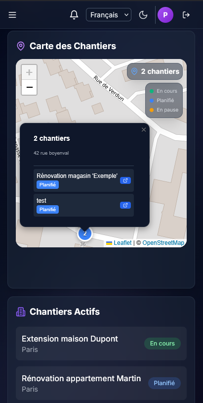
Centralised map
All georeferenced sites on one view for an immediate read of field activity.
Structured addresses
Site records keep city, postcode and coordinates for reliable map display.
Office and field
The map runs in the browser—handy in meetings or on a phone on site.
Trip planning
Spot nearby sites visually to chain visits and cut drive time.
The map as a management tool
For companies covering many towns or regions, geolocation is not a gimmick—it is an organising lever. Chantiax embeds the map in your existing workflow, no separate mapping tool.